- Thumbnail
- Resource ID
- 65ce1452-6f6a-11e9-8d7d-000d3ab6a624
- Title
- TM-BRB_Beaches - 2015 -1 :5000
- Date
- May 5, 2019, 2:17 p.m., Publication
- Abstract
- This dateset displays beaches around the island of Barbados. This dataset began with a compilation of various datasets, supplemented with any original digitization efforts. This information was then checked against high resolution satellite imagery where available from Bing and Esri imagery basemaps. Errors and misrepresentations in the base information were modified through heads up digitization from the high resolution imagery. Omissions of coverage were corrected by creating new polygons to match visible beaches.
- Edition
- --
- Owner
- gridanode
- Point of Contact
- devrsgis@gmail.com
- Purpose
- --
- Maintenance Frequency
- None
- Type
- not filled
- Restrictions
- None
- None
- License
- None
- Language
- eng
- Temporal Extent
- Start
- --
- End
- --
- Supplemental Information
- No information provided
- Data Quality
- --
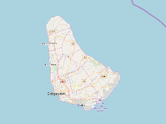
- Extent
-
- long min: -59.6539965744
- long max: -59.4189433480
- lat min: 13.0452610060
- lat max: 13.3307696389
- Spatial Reference System Identifier
- EPSG:900913
- Keywords
- no keywords
- Category
- None